Products & Services
Navisys
Navisys is a tool software used for realization of direction well trajectory design and calculation of real time drilling of wellbore trajectory, which has the function of anti-collision scanning calculation and conversion of coordinates.
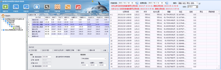
Direction well trajectory design: support mainstream design algorism, support industrial standard of ‘Directional Well Trajectory Design and Trajectory Calculation SY-T 5435-2003’, supportive of design result output and multiple style targets design.
Borehole real time trajectory computation: support multiple trajectory computation, the minimum curvature, curvature radius, (cylindrical spiral line) algorism, an average angle algorism, and the balance tangent algorism.
Anti-collision scanning computation: support multiple trajectory computation algorism, support ‘Cluster Well Borehole Anti-collision Technology Requirement SY/T 6396-1999’
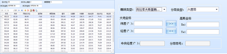
Conversion of coordinates: Gausse coordinates and 2-way conversion with longitude and altitude.